Skip to the spot

Schleswig-Holstein, Germany

Oct · 84% rideable

Sylt

What it's actually like

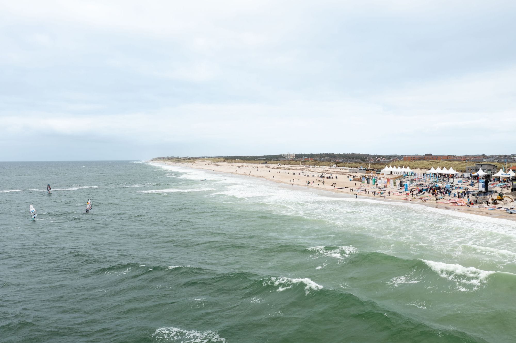
Sylt is a North Sea island off the coast of Schleswig-Holstein, reached by car train over the causeway from Niebüll. It has two coasts a short drive apart. The west side faces the open North Sea, with beach break, groynes and current.

The east side looks onto the Wadden Sea, shallow and flat but ruled by the tide. The wind decides which coast, and the tide decides when.

Duotone Pro Center Sylt says it works in north, north-west, west, south-west and south winds, that the shorebreak can reach 2 to 3 metres, and recommends it to advanced riders only.

Spotted something out of date? Tell us

Your month

When it's good

12 kt+ for 3+ daylight hours · kite

October · 84%. 26 rideable days in 31, 9.9 hours a day over 12 kt. Come.

Where else it blows in October

At a glance

Is it for you?

Skill levelComfortable
WaterMixed bag
Wind · OctUsually turns up
Crowds · OctBusy patches
Local vibeFriendly enough
Water qualityUsually clean
NightlifeA bar or two
CostMid

Geek analysis

October in the record

84% of days clear 12 kt for three daylight hours or more.

In October the wind most often sits at 12 to 15 kt (28% of daylight hours) and is over 12 kt from 8am to 6pm on at least half the days. See both charts in the full report

October on the record

The month's own figures, not the year's average.

Rideable days26 of 31Nine Octobers in the record
Strongest measured gust85 ktOctober 2013, DWD List auf Sylt station, 6.5 km away. Twenty-nine Octobers measured, 1996 to 2025. Station, not the beach.
Wind, rideable hours18 ktMean over daylight hours at 12 kt+
Air12.9°CMaximum

Take it with you

The full Sylt report

Seven sections over six pages, built from the same record as this page. A PDF you can read on the plane.

01Hour-by-hour & month-by-month wind02The month's own records03Full stays, schools & kit04Per-launch tide windows05Groynes, currents & the national park06Getting there, packing & best months07Sources, and their limits

When it gets busy

Crowds

Jan · Low

Busiest from June to September. The Kite-Surf World Cup runs at Brandenburger Strand from 25 to 30 August 2026. The windiest winter months are the quiet ones. Compiled research, not a count.

On the water

What October usually does

Wind directionAnyThe west coast from north round to south; the Wadden side, Königshafen and Möwennest, in the easterlies.
Wind strength18 to 19 ktThe mean over rideable daylight hours, October to February, corrected against the List auf Sylt station.
When it blowsAll dayThe share of windy days barely moves from 8am to 6pm in the record.

Your playground

Launches & safety

Conditions change. Check local rules and conditions before you ride.

  • Launch
  • Hazard
  • Parking
  • School
  • Stay
  • Webcam
  • Approximate

Local intel

Getting there & on the ground

Nearest airportSylt (GWT)On the island at Westerland. Scheduled flights from Frankfurt, Munich, Düsseldorf and others.
On the groundOctober to FebruaryThe windiest months in the record. January is the pick.
Getting aroundCar train, then a carThe DB Sylt Shuttle carries cars from Niebüll to Westerland over the causeway in about 35 minutes.
Stay, schools & kit

Who works this beach

© Sabine J.Duotone Pro Center SyltSchool$$$MidGoogle MapsKite · Wing · WindsurfLessons in Westerland: kite from 150 euros, windsurf from 120, wing from 250.
© pixel_kCampOne SyltSchoolGoogle MapsKite · Wing · WindsurfSchool at the Ellenbogen in List, May to October.
© YK. KaoKiteschule SyltSchoolGoogle MapsKite · Wing · WindsurfLessons and kids camps at Königshafen on the Ellenbogen.
© Surfhouse SyltSurfhouse SyltSchoolGoogle MapsKite · WingKite, wing and wave lessons from a base on Campingplatz Westerland, with beginner kite courses of two students per instructor, mostly at the Ellenbogen in List.Website
© Andreas BreckleWaves and Wind Wassersport SyltSchoolGoogle MapsKite · Windsurf · WingKönigshafenKite, windsurf and wing lessons on the flat Lister Wadden Sea from Hotel Strand am Königshafen, April to October, with rental.Website

All 7 stays near Sylt on one page

Something wrong?We check before it changes.Suggest a change

Sources

Wind dataOpen-Meteo · ECMWF IFS HRES 9 km · 2017 to 2026Weather data by Open-Meteo.com, licensed under CC BY 4.0. The figures on this page are statistics we counted from that data. Model data: European Centre for Medium-Range Weather Forecasts (ECMWF), CC BY 4.0. Contains modified Copernicus Climate Change Service information 2026 (ERA5). Neither the European Commission nor ECMWF is responsible for any use that may be made of the Copernicus information or data it contains. Station data: Deutscher Wetterdienst (DWD), Climate Data Center. Derived figures, not the published values. Licence: CC BY 4.0 (Deutscher Wetterdienst, GeoNutzV).
Map data© OpenStreetMap contributors · ODbL
PhotosHero, Windsurfers off Brandenburger Strand, Westerlanddronepicr · Wikimedia Commons · CC BY 2.0Brandenburger Strand, Westerland.Heidrun Zgoll-Nitzsche · Google Maps · Google Maps Platform termsSurf on the west beach, Westerland.Gerhard Möller · Google Maps · Google Maps Platform termsThe dunes and the beach, Westerland.Chloé · Google Maps · Google Maps Platform termsSchool, Duotone Pro Center SyltSabine J. · Google Maps · Google Maps Platform termsSchool, CampOne Syltpixel_k · Google Maps · Google Maps Platform termsSchool, Kiteschule SyltYK. Kao · Google Maps · Google Maps Platform termsSchool, Surfhouse SyltSurfhouse Sylt · Google Maps · Google Maps Platform termsSchool, Waves and Wind Wassersport SyltAndreas Breckle · Google Maps · Google Maps Platform terms