Skip to the spot

Dodecanese, Greece

Feb · 60% rideable

Prasonisi

What it's actually like

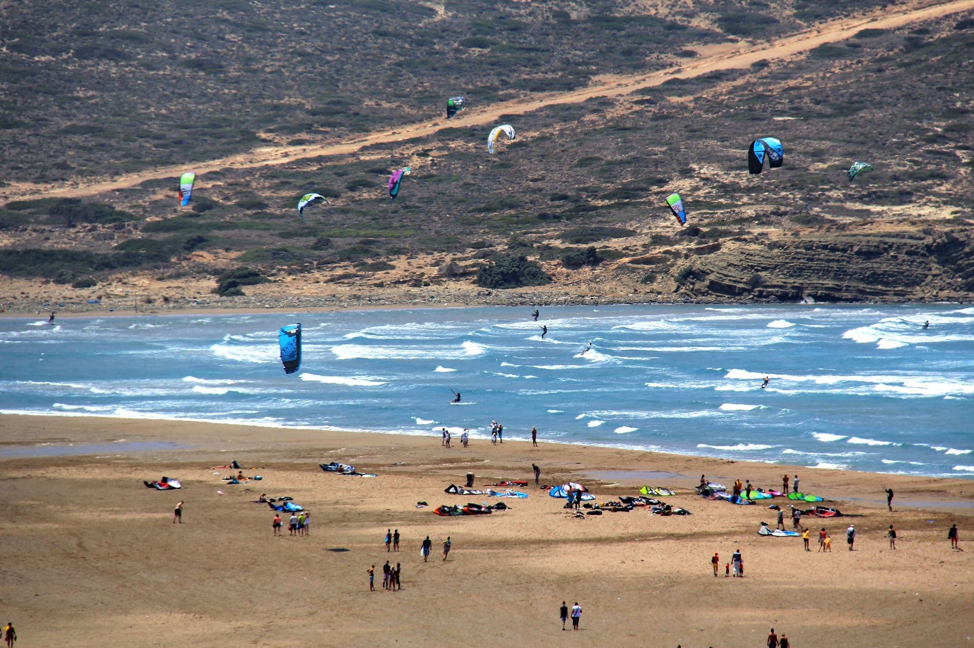
Prasonisi is the southern tip of Rhodes, where a narrow sand spit joins the island to a small islet. The spit has a sea on each side: flat water in the lee on one side, rolling waves on the other. It is remote, at the end of the island, a short drive past the village of Kattavia, and there is little here but sand, the centres and a few places to stay.

The summer Meltemi is the reason to come. It blows from the north-west and gets a local boost around the cape, and the record agrees: from June to September close to nine days in ten clear 12 knots for three daylight hours or more, and August is the pick at 94 per cent. The mean over those rideable hours is about 17 knots. The wind blows through the day and builds a little into the evening: in July about two in three days are windy at 8am and nine in ten by 6pm. The rest of the year is lighter but not empty, with around half of days rideable in autumn and winter.

Spotted something out of date? Tell us

Your month

When it's good

12 kt+ for 3+ daylight hours · kite

February · 60%. 17 rideable days in 28, 6.9 hours a day over 12 kt. Come.

Where else it blows in February

ERA5 puts the share of rideable days 15.8 points lower here, and no weather station has settled it, so treat these figures as a guide.

At a glance

Is it for you?

Skill levelComfortable
WaterMixed bag
Wind · FebUsually turns up
Crowds · FebBusy patches
Local vibeFriendly enough
Water qualityUsually clean
NightlifeEarly nights
CostMid

Geek analysis

February in the record

60% of days clear 12 kt for three daylight hours or more.

In February the wind most often sits at 12 to 15 kt (23% of daylight hours) and is over 12 kt from 12pm to 6pm on at least half the days. See both charts in the full report

No weather station near enough to check these figures against.

February on the record

The month's own figures, not the year's average.

Rideable days17 of 28Four Februaries in the record
Wind, rideable hours17 ktMean over daylight hours at 12 kt+
Air14.9°CMaximum

Take it with you

The full Prasonisi report

Seven sections over six pages, built from the same record as this page. A PDF you can read on the plane.

01Hour-by-hour & month-by-month wind02The month's own records03Full stays, schools & kit04Per-launch notes on both sides05Greek rules, the kite zone & offshore drift06Getting there, packing & best months07Sources, and their limits

When it gets busy

Crowds

Aug · High

Prasonisi Center says it can be very crowded on the water in July and August, with not too many sailors in June and a lot of space in May, September and October. Kiteguide notes a relatively small kitesurfing area.

On the water

What February usually does

February sits outside the best months here. 60% of days clear 12 kt for three daylight hours or more.

Your playground

Launches & safety

Conditions change. Check local rules and conditions before you ride.

  • Launch
  • Hazard
  • Parking
  • School
  • Stay
  • Webcam
  • Approximate

Local intel

Getting there & on the ground

Nearest airportRhodes (RHO)About 94 km by road, near two hours.
Flying with a board bagJet2.com, easyJet, TUI Airways, RyanairAirlines flying into Rhodes (RHO). Each links its own sports-equipment page: check its rules and fees before you book.Jet2.comeasyJetTUI AirwaysRyanairWikipedia, Rhodes International Airport · Checked Oct 2026
On the groundJune to SeptemberThe Meltemi months in the record. August is the pick.
Getting aroundCarThe spot is remote, at the end of the island. Kattavia is a short drive away.

Stay, schools & kit

Who works this beach

© Vincenzo RomanielloKite PrasonisiSchoolGoogle MapsKite · WingIKOKite, wing and surf lessons for beginner, intermediate and advanced riders.Website
© Toyota Prasonisi Center Wingfoil, Kite & WindsurfingToyota Prasonisi CenterSchoolGoogle MapsWindsurf · WingWindsurf and wing rental and training for over 30 years. Open May to October.Website

All 6 stays near Prasonisi on one page

Something wrong?We check before it changes.Suggest a change

Sources

Wind dataOpen-Meteo · DWD ICON-EU 7 km · 2022 to 2026Weather data by Open-Meteo.com, licensed under CC BY 4.0. The figures on this page are statistics we counted from that data. Model data: Deutscher Wetterdienst, CC BY 4.0. Contains modified Copernicus Climate Change Service information 2026 (ERA5). Neither the European Commission nor ECMWF is responsible for any use that may be made of the Copernicus information or data it contains.
Map data© OpenStreetMap contributors · ODbL
PhotosHero, Kites off the Prasonisi isthmuspatano · Wikimedia Commons · CC BY-SA 3.0, croppedThe Prasonisi isthmus from above.Stanislav Kaska · Google Maps · Google Maps Platform termsKites rigged on the beach at Prasonisi.Anton Kapranchuk · Google Maps · Google Maps Platform termsThe bay at Prasonisi with kites out.Patrick Neumann · Google Maps · Google Maps Platform termsKites over the sand at Prasonisi.Lucky Outtrabady · Google Maps · Google Maps Platform termsSchool, Kite PrasonisiVincenzo Romaniello · Google Maps · Google Maps Platform termsSchool, Toyota Prasonisi CenterToyota Prasonisi Center Wingfoil, Kite & Windsurfing · Google Maps · Google Maps Platform terms