Western Cape, South Africa
May · 20% rideableCape Town - Melkbosstrand
What it's actually like
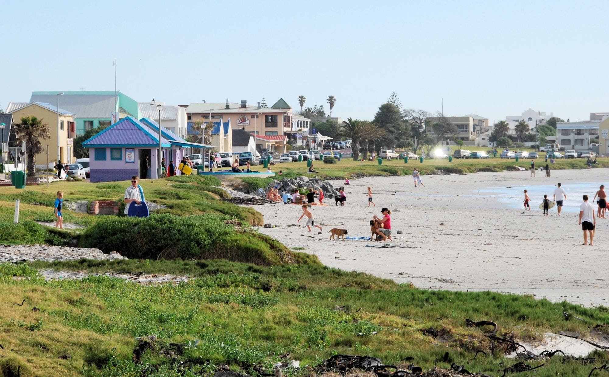
Melkbosstrand is the northernmost of Table Bay’s beach breaks: a very wide beach of white sand, seven kilometres long by the City’s count, about 12 minutes’ drive north of Big Bay and 10 to 15 km from Dolphin Beach. It picks up more swell than the spots closer to town and has less wind than Table View, and it is the wave-and-jump end of the bay.
November to February is the season. In each of those months about two days in three or more clear 12 knots for three daylight hours, and January is the pick, at about three in four. The mean over those rideable hours is about 15 knots. It is an afternoon wind: in January the share of windy days rises from about one in seven at eight in the morning to about seven in ten by four in the afternoon. May is the quietest month, at one day in five. The kite guide gives October to March as the best months, and Ben Proffitt has filmed it cranking on a 4 m sail.
Open Ocean hires windsurf and kite kit by the day from its shop at Big Bay, about 12 minutes south, and the Blouberg schools teach at their own beaches.
Spotted something out of date? Tell us
Your month
When it's good
12 kt+ for 3+ daylight hours · kite
May · 20%. 6 rideable days in 31, 1.7 hours a day over 12 kt. Go elsewhere.
Not yet checked against a weather station or an independent model, so treat these figures as a guide.
At a glance
Is it for you?
Geek analysis
May in the record
20% of days clear 12 kt for three daylight hours or more.
In May the wind most often sits at 4 to 7 kt (43% of daylight hours). No daylight hour is over 12 kt on at least half the days. The best hours are 2pm to 3pm, each on 19% of days. See both charts in the full report
No weather station near enough to check these figures against.
May on the record
The month's own figures, not the year's average.
Take it with you
The full Cape Town - Melkbosstrand report
Seven sections over six pages, built from the same record as this page. A PDF you can read on the plane.
When it gets busy
Crowds
A kite guide calls Melkbos very popular and crowded on good days, with hundreds of windsurfers out on a day of decent wind and waves and surfers usually upwind. WindChaser has no crowd count by month yet.
On the water
What May usually does
May sits outside the best months here. 20% of days clear 12 kt for three daylight hours or more.
Your playground
Launches & safety
Conditions change. Check local rules and conditions before you ride.
- Launch
- Hazard
- Parking
- School
- Stay
- Webcam
- Approximate
Local intel
Getting there & on the ground
Stay, schools & kit
Who works this beach
Nothing listed here yet
If you run one on this beach, put it on the map.
All 4 stays near Cape Town - Melkbosstrand on one page